Home
Project Goals
The purpose of the Safe Road Zone (SRZ) grant is to:
- identify and prioritize key hot spot crash locations
- determine contributing factors
- develop potential improvement alternatives
Traffic analysis
The sliding images below show crash data for different categories along Hwy 169 in Shakopee. Let us know if the data lines up with your experience using the road.
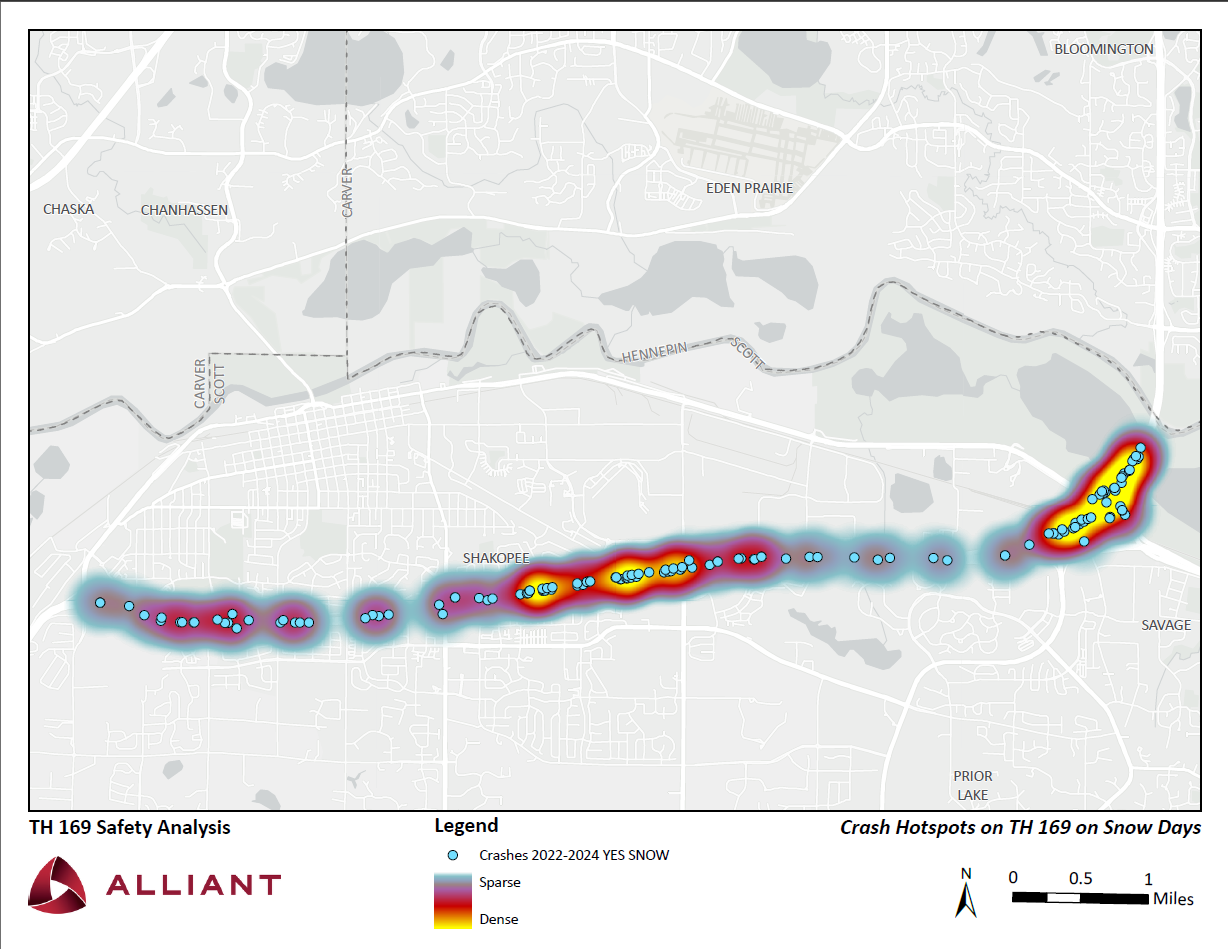
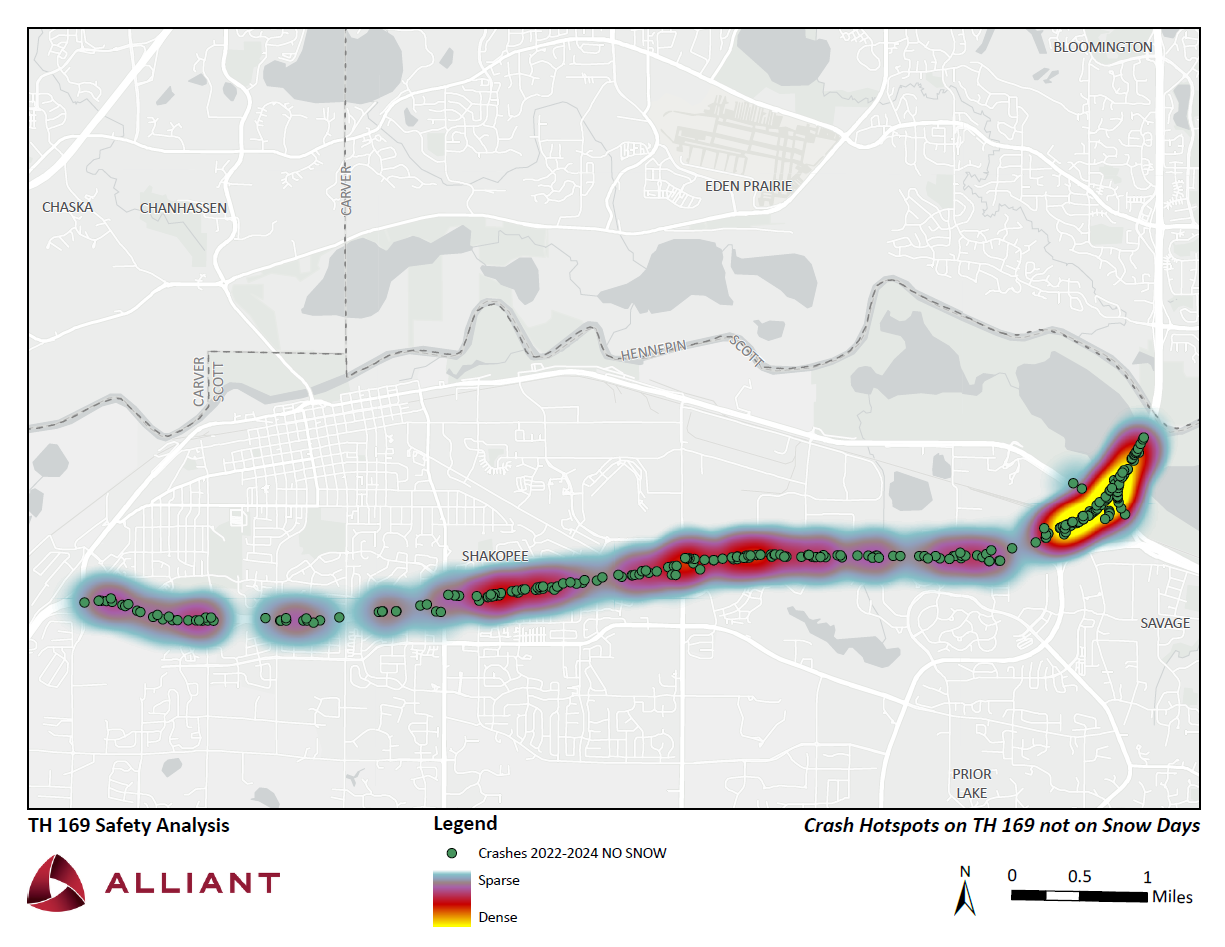
The sliding image above shows that the crash density increases between Marschall Rd and Canterbury Rd when snow is present. When there is no snow present, crashes cluster around the bridge.
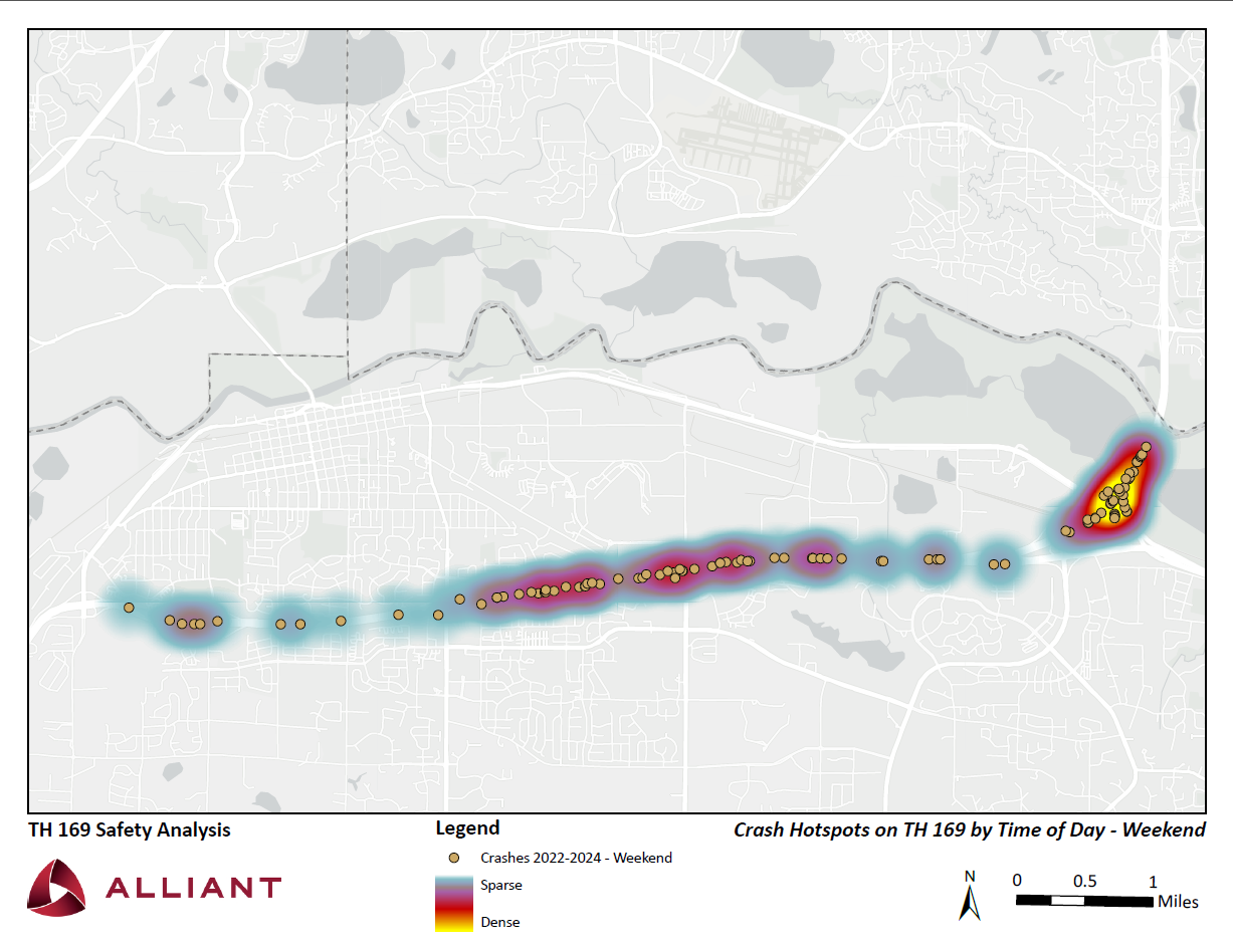
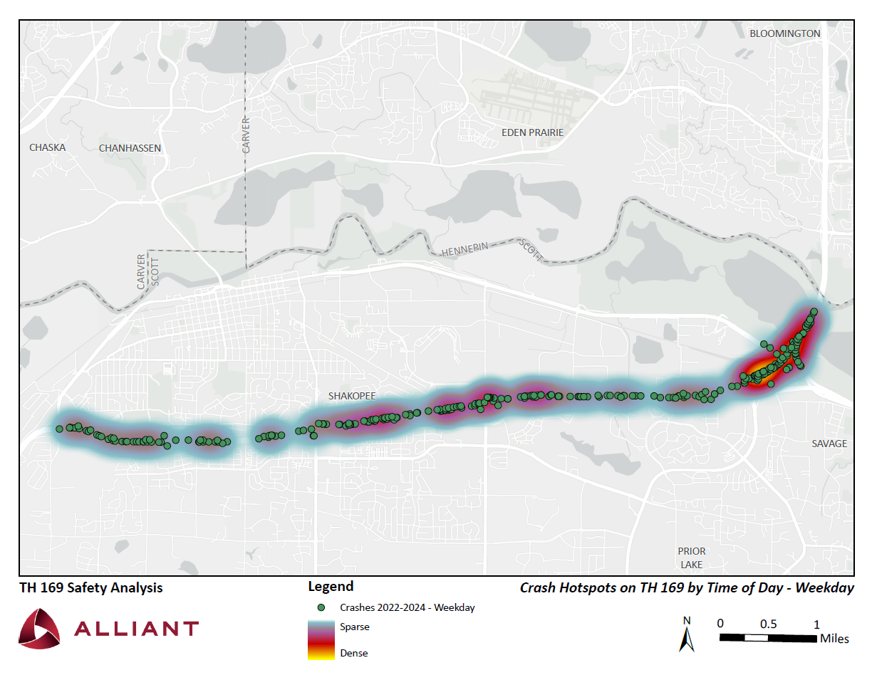
The sliding image above indicates that crashes are fewer and more spread out on the weekends as compared to weekday crashes.
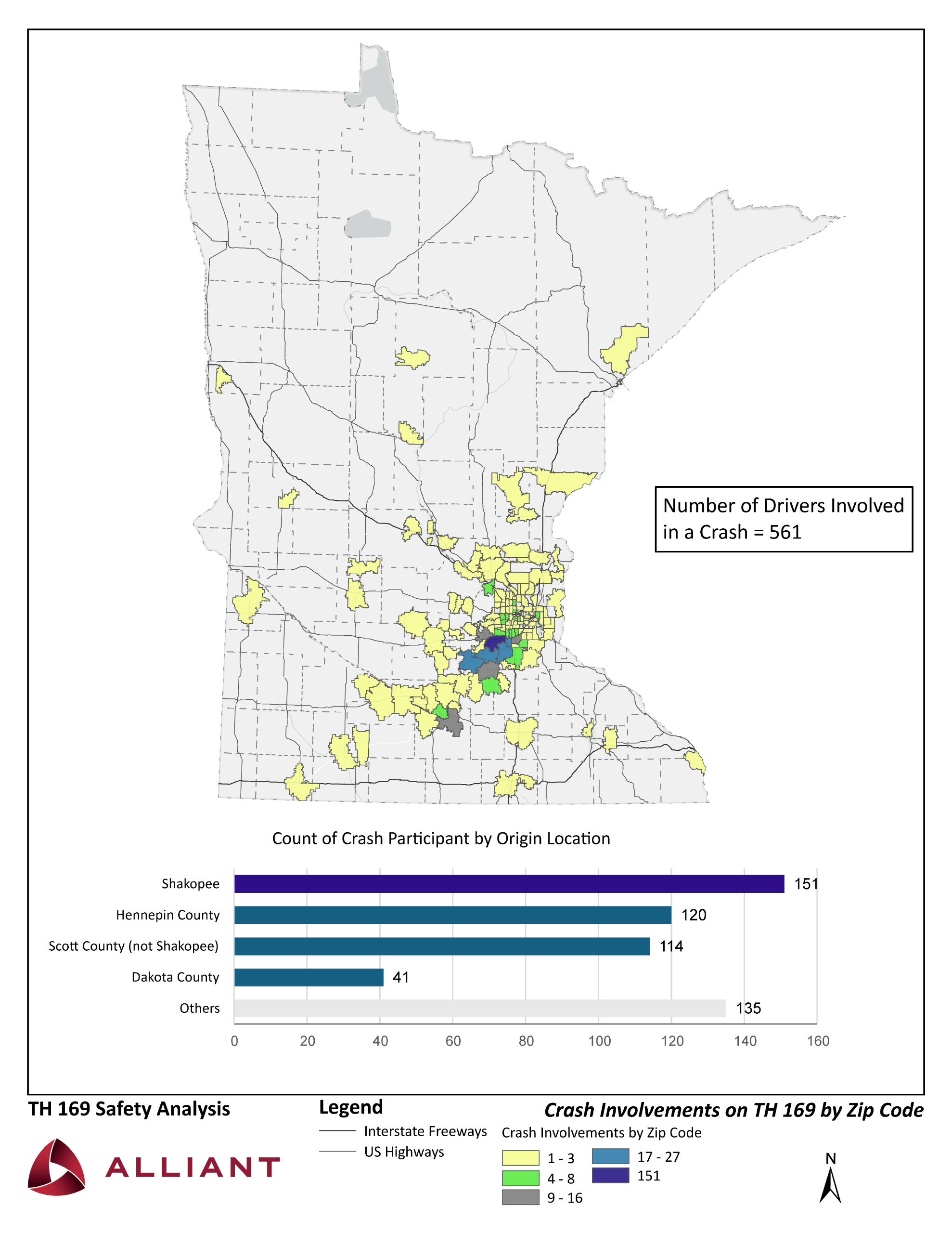
This image indicates that only 25% of crashes that occur along Hwy 169 involve Shakopee residents. 75% of crashes involve drivers from other zip codes.


